Village
Ak-Shyyrak
- Territory type
- Village
- Community
- Ak-Shyyrak
- Landscape
- Highland & Peaks
Territory notes
The field account
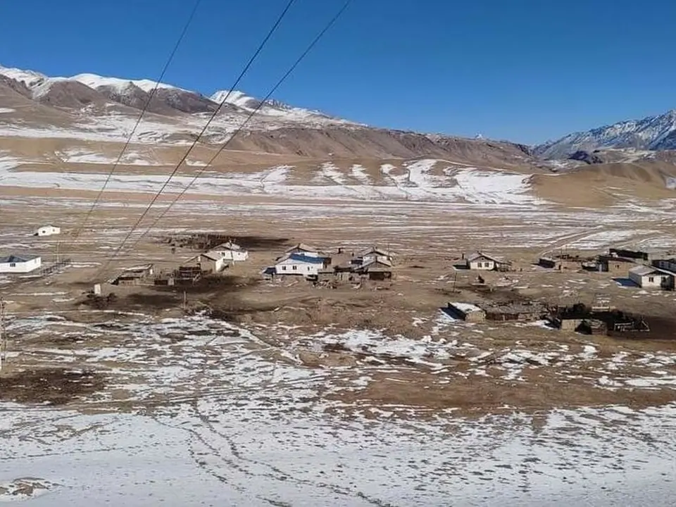
Losted village at the end of the road A364 starting from Barskoon. The linked road from Ak-Shirak village to Enilchek village never was finished.
Ak-Shirak is now a hamlet, and officially bringing together dozens of farms within a radius of 100 km.
Ak-Shyirak village is 230 km away from the district centre. The village is located at 3200-3500 meters above sea level. It consists of 3 villages; Uch-Koshkon village is the centre of the village with 192 residents, Ak-Shyirak village with 68 residents, Yshtyk village with 26 residents and Kara-Sai village with 61 residents in total 347 residents.
Winter in Ak-Shyirak village lasts about 8-9 months, in summer the climate is cool, sometimes it even snows in summer.
Map margin
Where it sits
The map marks an orientation point for this territory; it does not describe its boundary.
Geographic index
Within this territory
7 destinations in the catalogue
Sights and natural places
-
Soek pass (Arabel-Suu)
Pass · 4028 m
-
Kumtor Mine
Sight · 3620 m
-
Kumtor valley
Sight · 3600 m
-
Sarychat-Ertash reserve
Nature Site · 3100 m
-
Ishtik pass
Pass · 3689 m
-
Arabel Suu syrt
Jailoo · 3750 m
-
Ishtik ancient caravanserail site
Historical Site · 3330 m
Visual field notes
A closer look