
Silk Road Guide
Afghanistan
Experience Afghanistan authentically. Engage in cultural exchange, sharing stories and traditions with locals. Join a journey not just to witness but to actively be a part of Afghanistan's story, all while respecting its

Silk Road Guide
Orient your journey
Experience Afghanistan authentically. Engage in cultural exchange, sharing stories and traditions with locals. Join a journey not just to witness but to actively be a part of Afghanistan's story, all while respecting its remarkable nature and communities. Discover the headlines' land in a whole new light.
-
01
Entry and exit formalities
Visas, borders and documents.
Open chapter -
02
When to go and weather
Seasons, weather windows and road conditions.
Open chapter -
03
Getting around
Roads, passes, distance and travel time.
Open chapter
Silk Road Guide
Read the land
Use the authored regions to build a first spatial picture, then open each region for local detail.
Regional field key
- 01 BadakhshanBadakhshan is Afghanistan’s far northeast, centered on Faizabad and shaped by the Kokcha, Panj and Wakhan-facing valleys. High roads, river borders, winter closures, market towns and recent …
- 02 BadghisBadghis is a northwestern hill and steppe province centered on Qala-e-Naw. Dry grazing land, market roads, Herat-facing movement, seasonal water and Turkmen border proximity make it a provin…
- 03 BaghlanBaghlan is a corridor province. Pul-e Khumri, Kunduz River fields, industrial memory and the Salang-facing road system show how movement between Kabul and the northern plains tightens throug…
- 04 BalkhBalkh is anchored by Mazar-i-Sharif and the older city of Balkh, where shrine life, markets, settlement memory and Amu Darya-facing roads meet. Its heritage remains inhabited through prayer,…
- 05 DaykundiDaykundi is a central highland province around Nili, shaped by mountain agriculture, village routes and difficult winter movement. Hazara community life, fields, fuel, schooling and road tim…
- 06 FarahFarah is a western desert-edge province, not empty country. Farah city, the Farah River, irrigated patches, dry settlements and routes toward Herat, Kandahar and Iran show how heat, water, r…
- 07 FaryabFaryab is a northwestern province of Maymana, dry farming, market towns and steppe-facing roads. Uzbek and Turkmen cultural layers appear where locally relevant, but the main grammar is fiel…
- 08 GhazniGhazni Province centers on Ghazni city, highland cold, Islamic intellectual memory and the Kabul-Kandahar road. Minaret and citadel remains matter, but so do traffic, markets, fields, winter…
- 09 GhorGhor is a mountain province of Firozkoh, Hari Rud valleys and the Minaret of Jam, where heritage stands inside distance rather than apart from it. Weather, road condition, village life and w…
- 10 HelmandHelmand Province is defined by the Helmand River basin, Lashkar Gah, irrigation canals, desert roads and agricultural transformation. Its geography is water under pressure: fields, channels,…
- 11 JowzjanJowzjan is a northern plains province with an industrial and market rhythm. Sheberghan, gas-field roads, agricultural settlements and routes toward Balkh and Faryab make the province a worki…
- 12 KandaharKandahar is southern Afghanistan with urban gravity: Kandahar city, Arghandab orchards, market streets, Durrani memory and roads toward Helmand, Ghazni and Pakistan. It needs serious context…
- 13 KapisaKapisa is a small province with a precise geography north of Kabul. Mahmud-e Raqi, orchard valleys, Kohistan and Kohband roads, Panjshir adjacency and Parwan links make it a compact capital-…
- 14 KhostKhost is a southeastern province centered on Khost city, with mountain edges, markets and Pakistan-facing road movement. Border proximity belongs to practical geography: local advice, permis…
- 15 KunarKunar is an eastern river-valley province centered on Asadabad, where the Kunar River, forested slopes, bridges and Nuristan-facing mountains organize road movement. Water, slope, border pro…
- 16 KunduzKunduz is one of northern Afghanistan’s field-and-road provinces. Kunduz city, the Kunduz River plain, irrigated agriculture, markets and Sher Khan Bandar route context make it a dense place…
- 17 LaghmanLaghman is an eastern province of orchards, river valleys and road movement. Mehtar Lam, Alingar and Alishing valleys, Kabul River system context and routes toward Nangarhar and Kunar make i…
- 18 LogarLogar is Kabul’s southeastern valley threshold, centered on Pul-e Alam, Logar River fields and roads toward Gardez and Ghazni. Mes Aynak adds copper and Buddhist archaeological memory, while…
- 19 NangarharNangarhar is eastern Afghanistan’s warm lowland province: Jalalabad, the Kabul River, citrus and field work, bazaars, university-town traffic and Torkham-Khyber route pressure all sit inside…
- 20 NimruzNimruz is Afghanistan’s southwestern desert-border province. Zaranj, Sistan basin memory, Helmand-delta water, Iran-facing roads, trucks, heat and dry crossings make it a place where borders…
- 21 NuristanNuristan is a forested eastern mountain province centered on Paroon, distinct valley communities and difficult roads. Nuristani identity, river valleys, tree cover, weather, community permis…
- 22 PaktiaPaktia is a southeastern mountain province centered on Gardez, where passes, markets and roads toward Kabul and Khost shape movement. Its travel logic sits in weather, slope, local advice, s…
- 23 PaktikaPaktika is a southeastern border province of dry highlands, Sharan, dispersed settlements and Pakistan-facing roads. It is best read through distance, markets, community expectations, curren…
- 24 PanjshirPanjshir is a narrow mountain province north of Kabul, organized by the Panjshir River, Bazarak, valley villages and high slopes. Its resistance memory needs careful handling, without heroiz…
- 25 ParwanParwan is a Kabul-north corridor province where Charikar, Bagram, Salang approaches, Ghorband-side roads, fields and market traffic gather before the Hindu Kush tightens movement. Road condi…
- 26 SamanganSamangan is a northern province centered on Aibak, with Takht-e Rostam, cave heritage, highland-steppe transitions and roads between Balkh and Baghlan. Heritage sits beside working traffic, …
- 27 Sar-e PolSar-e Pol is a northern interior province of fields, dry hills and linking roads. Sar-e Pol city, agricultural valleys and routes toward Jowzjan, Balkh and central highland approaches make m…
- 28 TakharTakhar is a northeastern agricultural province where Taloqan, fields, Kokcha-side routes and roads toward Kunduz, Badakhshan and Tajik borderlands create a working landscape of markets, vall…
- 29 UruzganUruzgan is a central-southern highland province built around Tarinkot, valleys, dry mountains, fields and difficult roads. Agriculture, local movement, water points and access reality matter…
- 30 WardakWardak is Kabul’s western highland threshold, centered on Maidan Shahr and shaped by fields, passes and roads toward Bamiyan and Ghazni. Its geography is close to the capital yet ruled by we…
- 31 ZabulZabul is a southern highland corridor centered on Qalat, dry hills, valley settlements and the Kabul-Kandahar road. Its value is in route memory, road discipline, water decisions, local conf…
- 32 Kabul
- 33 Bamyan
- 34 Herat
Silk Road Guide
Explore the guide
01 PlanTiming, first decisions and the shape of the journey.
02 RouteArrivals, transport and movement across the country.
03 Stay & eatHow accommodation and food work on the road.
- Places to eatRestaurants and food stops worth knowing.
- EatingLocal food, meals and dining expectations.
- ShoppingMarkets, crafts and what can leave the country.
- EntertainmentPerformances, evenings and cultural venues.
- Drinking and nightlifeEvening options and local expectations.
- SleepingWhat overnight comfort means on the road.
04 PracticalBorders, money, health and everyday travel realities.
05 UnderstandCulture, history and context for traveling with care.
Afghanistan
Dispatches from the country
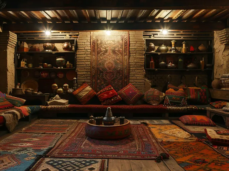
Sleeping in Afghanistan
AfghanistanUseful Information
A practical reference for Afghanistan; contacts, services, opening times and local access should be verified before being used in a live route.