Sights

Boom gorge

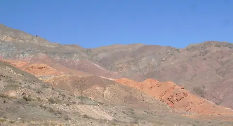
The main main road connects the Oblast of Chuy and that of Issyk Kul by a canyon 40 km long. But this passage was only opened during the expedition led by explorer Pyotr Semionov-Tian-Chanski in 1857. The colors of the rocks are incredible. You can visit several small canyons with red rocks like the Creek canyon.

Boom Gorge
Kyrgyzstan
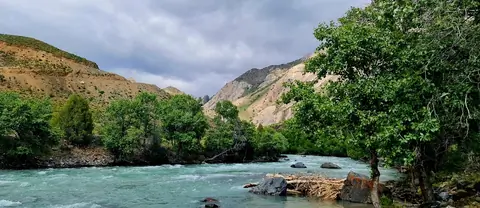
Chatkal valley

The Chatkal valley follows the mountain chain of the same name, to the north-west of this chain, over a length of 160km before flowing into the Charvak dam in Uzbekistan. By road, there are only 2 accesses, either by Talas to the north and the Kara-Bura Ashuu pass located at 3302m. alt .; or from the south, via the Chapchyma Ashuu pass 2841m. alt. when arriving from the town of Kerben.

The capital is the village of Kanysh-Kyya, and the lower part of the valley is in the Besh-Aral nature reserve.

Chatkal
Kyrgyzstan

Chatyr-Kul lake

Chatyr-Kul lake is an endorheic lake on the south-western side of the At-Bashi  range in the district of Naryn Province. On the south, the road linking Bishkek to Kashgar runs alongside the lake and exceptional mineral water sources. But it is above all the summer habitat of many species of migratory birds. The name of the lake means “Celestial Lake” in Kyrgyz (literally "Roof Lake"). The lake and around it is part of the Karatal-Japyryk State Nature Reserve. The lake is a Ramsar site of globally significant biodiversity.

At-Bashi
Kyrgyzstan

Chokoly lakes

The Chokoly Lakes or Chokoli-Kol Lakes are a group of a dozen lakes on the south side of the Juuku Pass. Only the large lake on the east side has a river flowing into the Arabel Suu River. The length of the largest lake is about 3 km.

As soon as you wake up and decide to look out of the tent, you are immediately greeted by an incredible view of the lake, which, like a natural mirror, beckons with its beauty in the early morning.

Probably this is one of the most beautiful places, which is great for camping.

Jeti-Ögüz
Kyrgyzstan

Chong-Ak-Suu gorge

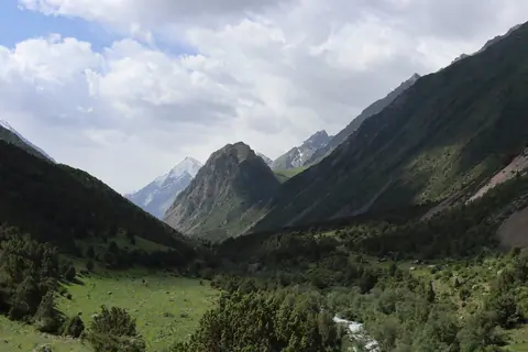
The Chong-Ak-Suu valley or also called Grigorivka, stretches for 35 km in the Kungey Alatoo massif, between Lake Issyk Kul and the Kazakh border. The river of the same name is bordered to the north by cliffs and very steep slopes, while to the south, large pastures cover the mountains. The valley is very visited in summer by tourists who come to rest on the shores of Lake Issyk Kul.

Grigorievka
Kyrgyzstan

Alamedin gorge

The Alamedin valley is one of the 2 valleys supplying water to the city of Bishkek. It lies to the east of the Ala Archa valley. It is very popular and owes its development during the Soviet era with the construction of a sanatorium around the mineral hot springs. The valley attracts many walkers, picnickers but also mountaineers because it is surrounded by the highest peaks of Kyrgyz Alatoo, such as the Simeon Tienshansky peak 4875m. alt. and the Alamedin Wall culminated by the Kyrgyzstan peak at 4840 meters.

Alamedin
Kyrgyzstan

Alay Valley

Image
Alay valley
Height
912
Width
1480

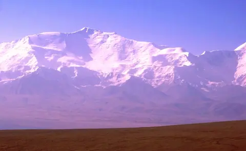
The Alay valley is bordering Tajikistan on the South of Kyrgyzstan. The river name Kyzyl Suu or the "red river" and flew into Tajikistan. It's part of the Kyrgyz Pamir or named also Pamir Alay. The valley is wellknown for large flocks of yacks but also for its wellknow peak named "Lenin". Gulsho is its administrative center, and Sary Mogol village is one of largest village of the valley. In winter, life conditions are particulary difficult.

Sary-Tash
Kyrgyzstan

Burana Tower

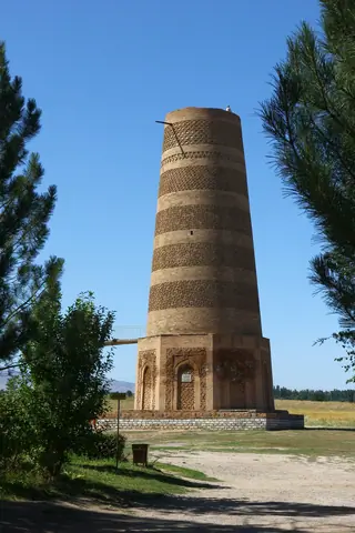
Burana Tower is seven km. far from the city of Tokmok. It is an 11th century minaret, and one of the first buildings of such type in Central Asia. The original height of minaret was 45 meters. Today the tower is 24.6 meters high, the remaining part came down during an earthquake in the 15th century. In the 10th to 12th centuries, Karakhanids khanate was a great feudal state of Central Asia and Kazakhstan.

Tokmok
Kyrgyzstan