Kyrgyzstan

Code value
KG
Nationality
Kyrgyz
Path Element
kyrgyzstan
Adjective
Kyrgyz

Nomad’s Land Featured in NatGeo: Explore the Epic Kyrgyz Nomad Trail

Description

Adventure awaits—and National Geographic just spotlighted the Kyrgyz Nomad Trail (KNT), the longest hiking route in Central Asia (1,243 miles and counting!), with Nomad’s Land named as a trusted ecotourism partner.

Dive into the full story here: "This is the longest hiking trail in Central Asia—here’s what to know before you try it"

Why This Matters

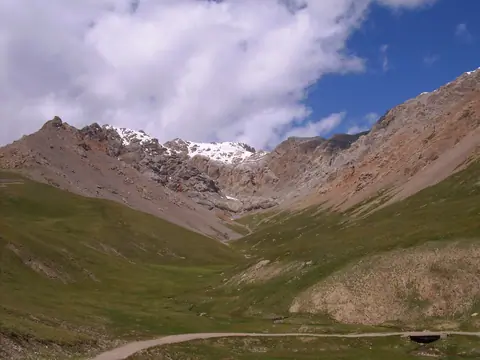
The KNT isn’t just a trail; it’s a transformative journey through Kyrgyzstan’s wildest landscapes—from the shimmering Ala-Köl lake to the ancient Silk Road caravanserai of Tash Rabat. By summer 2025, it’ll grow by another 621 miles, unlocking remote valleys like the Arpa and the soaring Pamir ranges.

As a KNT partner, we’re proud to:

  • Design sustainable hikes that support local shepherds and mountain communities.
  • Offer exclusive access to hidden gems (think: the Engilchek Glacier, the world’s 6th longest non-polar ice river!).
  • Prioritize safety—the trail is carefully routed away from conflict zones, with recent border agreements reopening stunning routes near Batken.

Hiking here is a real and serious challenge. Be respectful, hike responsibly, think sustainable, and create positive impact.
— Yuval Yellin, KNT Co-Creator

Ready to Trek?

We craft custom adventures for every pace—whether you’re chasing a week-long section or a month-long odyssey. June–September is prime time, and we handle visas, border permits, and logistics so you can focus on the magic.

Read article about the Kyrgyz Nomad Trail KNT : Kyrgyz Nomad Trail: Connecting People and Nature in Kyrgyzstan

and our article about the partnership with the KNT : Nomad's Land Connect People and Nature with Kyrgyz Nomad Trail

Read more about the Kyrgyz Nomad Trail in international media, including National Geographic and The New York Times.
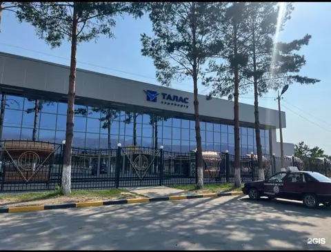
Talas Airport

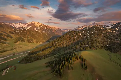
Talas Airport is located in the regional center of the same name at an altitude of 1,266 meters above sea level. It is a regional airport serving domestic flights of Kyrgyzstan.

The airport is located in the western part of Kyrgyzstan, in the valley of the Talas River, in close proximity to the city of the same name. Talas is the administrative center of the oblast of the same name and an important transportation hub of the region.

The runway of Talas airport is designed to serve the following types of aircraft:

An-2, An-26, An-28
Avro RJ85
UAE-146
Yak-40

Talas
Kyrgyzstan

Eco Farm Fazenda

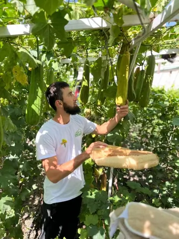
Eco-farm “Fazenda” is a unique place in the Jalal-Abad region, where care for nature and striving for quality environmentally friendly products are combined. The main pride of the farm is natural loofah loofah loofah loofah, grown using only organic methods.
In addition, there are 10 types of grapes, peaches, pomegranates and apricots, which fascinate with their taste and aroma. The farm organizes fascinating tours for its guests, where you can learn about the growing and harvesting process. You can also enjoy tasting fresh fruits and grapes, feel the taste of real natural products.

Jalal-Abad
Kyrgyzstan

Suluu Ter lakes

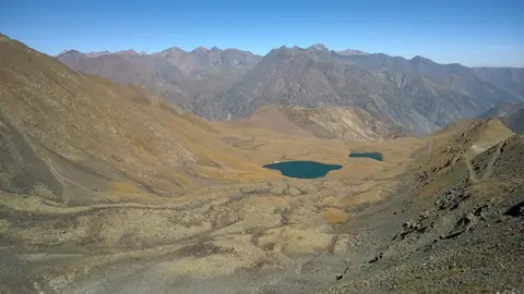
The Suluu Toer Lakes are nestled on the northern slopes of the Kyrgyz Alatoo mountain range. They can be easily reached on foot from the northern entrance of the Too-Ashuu tunnel, following the old road leading to the Too-Ashuu (or Ashuusu) Pass. The lower lake, a square-shaped basin, spans 160 meters in width and sits at an altitude of 3,191 meters. The upper lake, nearly 200 meters wide, lies 300 meters higher at an elevation of 3,245 meters. This area is perfect for a scenic 5-kilometer hike, taking approximately two hours each way.

Too-Ashuu
Kyrgyzstan