- Contains
Batken Region
Isfana border post
The Isfana border post stands as a significant point of entry and exit located in the western region, marking the boundary between Kyrgyzstan and Tajikistan. This border post is crucial for facilitating the movement of goods, services, and people between these two Central Asian countries. It plays a pivotal role in the economic and social interactions that occur daily across the border, serving not only as a checkpoint for customs and immigration procedures but also as a vital connection for cultural exchange and mutual understanding between the Kyrgyz and Tajik populations.
Isfana
Kyrgyzstan
Kyzyl-Bel
Kyzyl Bel pass (2484 m). In translation – the Red pass. Is in 24 km to the south of Naryn, on the way to Torugart. From the pass excellent opens it is visible the valley and a crest of At-Bashi in the east
Kyzyl-Bel
Kyrgyzstan
Isfana Airport
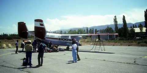
Isfana Airport started its operations in the 1940s as a landing strip near the town of Isfana, in Leylek district of the Batken Oblast. After Kalacha Airport, serving the coal mining town of Sulukta (16 km north of Isfana), was closed, Isfana Airport started serving Sulukta residents as well. The current runway and terminal were built in 1974. In the Soviet years, it received aircraft such as Yak-40, An-2, An-26, An-28, BAE-146-200 and helicopters of all types. It is a regional class 3C airport.
Isfana
Kyrgyzstan
Pyramidal peak
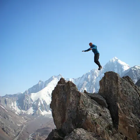
The Pyramidal peak is located on the crest of the Turkestan chain belonging to the Pamir-Alai massif. It is a monolithic granite mountain that attracts experienced climbers on mixed routes. It lies between the border of Tajikistan and Kyrgyzstan and 9 lanes have already been opened on the Kyrgyz side. The approach is made by going up the valley of Kara-Suu and by the glacier of Asan-Usin. The area is known as Karavshin, the valley that brings together the rivers surrounding the peak. It is the second highest peak in Turkestan after Skalisty peak, which is 5,612 meters high.
Karavshin
Kyrgyzstan
Sarkent national park
The Sarkent National Natural Park is located in the Bakten region, about 140 kilometers from the regional center - the city of Batken. The park covers an area of 40,000 hectares. "Sarkent" is the ancient name of the settlement where nomadic Kyrgyz lived. But over time, people migrated to the plain, and the name "Sarkent" remained.
"Sarkent" is one of the newest state parks, it was opened in 2009.
This park is inhabited by animals listed in the Red Book: brown bear, snow leopard, lynx, golden eagle and others.
Kyzyl-Kiya
Kyrgyzstan
Kyzyl-Kiya is a city of the Oblast of Batken founded in 1898 by the armies of the tsar for the exploitation of coal, it takes the status of city in 1938. The name means "Red Road" referring to the color of the mountains relatives. Its population is over 50,000 inhabitants. It is 150 km from Batken and 86 km from Osh. The city has no particular attraction but is located at the entrance of a long valley called Isfayram which leads to the peaks of Petit Alay.
- Geo
- Contains
Isfara - Batken border post : Kyzyl Bel
The border post of the Kyrgyz Oblast Batken provides access to the territory of Tajikistan. It is located on the main road between the cities of Batken and Isfara to reach the Tajik city of Khojand or the main Kyrgyz city of Osh. The post is at the exit of the small Kyrgyz village of Kyzyl Bel, and crosses the small mountain range of Kingyradyr.
Kyzyl-Bel
Kyrgyzstan
Karavshin gorge
The Karavshin valley arises from the confluence of 3 long valleys: Kara-Suu, Ak-Suu and Jaupaya whose sources are located in the Turkestan chain, which is part of the Pamir massif, on the border with Tajikistan and Kyrgyzstan. This region is known to climbers for its resemblance to the peaks of southern Patagonia, and often referred to as the Kyrgyz Patagonia.
Karavshin
Kyrgyzstan
Ak-Suu gorge
The valley of vertical cliffs including the peak Ak-Suu (5355 m), the peak Blok (5229m), the Dostoevskogo (4974m) and the peak Iskander (5120m).
Isfana
Kyrgyzstan