Places to visit in Afghanistan
39 places to visit found in Afghanistan
Badakhshan
State · Badakhshan
Badakhshan is Afghanistan’s far northeast, centered on Faizabad and shaped by the Kokcha, Panj and Wakhan-facing valleys. High roads, river borders, winter closures, market towns and recent route advice all matter…
Badghis
State · Badghis
Badghis is a northwestern hill and steppe province centered on Qala-e-Naw. Dry grazing land, market roads, Herat-facing movement, seasonal water and Turkmen border proximity make it a province of wind, livestock, small…
Baghlan
State · Baghlan
Baghlan is a corridor province. Pul-e Khumri, Kunduz River fields, industrial memory and the Salang-facing road system show how movement between Kabul and the northern plains tightens through valleys, trucks, weather,…
Balkh
State · Balkh
Balkh is anchored by Mazar-i-Sharif and the older city of Balkh, where shrine life, markets, settlement memory and Amu Darya-facing roads meet. Its heritage remains inhabited through prayer, trade, buses, fields,…
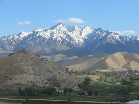
Bamyan
City · Bamyan
Bamyan is a city located in the central highlands of Afghanistan, in the Hazarajat region. The city is situated in a valley at an altitude of 2,500 meters and is surrounded by towering cliffs and snow-capped mountains…
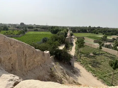
City of Balkh
City · City of Balkh
Balkh is an ancient town located in the northern part of Afghanistan, about 20 kilometers northwest of the city of Mazar-i-Sharif. It sits on the ancient Silk Road trade route that connected China with the Mediterranean…
Daykundi
State · Daykundi
Daykundi is a central highland province around Nili, shaped by mountain agriculture, village routes and difficult winter movement. Hazara community life, fields, fuel, schooling and road timing belong to the place…
Farah
State · Farah
Farah is a western desert-edge province, not empty country. Farah city, the Farah River, irrigated patches, dry settlements and routes toward Herat, Kandahar and Iran show how heat, water, road distance and market…
Faryab
State · Faryab
Faryab is a northwestern province of Maymana, dry farming, market towns and steppe-facing roads. Uzbek and Turkmen cultural layers appear where locally relevant, but the main grammar is fields, markets, livestock, road…
Ghazni
State · Ghazni
Ghazni Province centers on Ghazni city, highland cold, Islamic intellectual memory and the Kabul-Kandahar road. Minaret and citadel remains matter, but so do traffic, markets, fields, winter conditions, local…
Ghor
State · Ghor
Ghor is a mountain province of Firozkoh, Hari Rud valleys and the Minaret of Jam, where heritage stands inside distance rather than apart from it. Weather, road condition, village life and water shape every reading of…
Helmand
State · Helmand
Helmand Province is defined by the Helmand River basin, Lashkar Gah, irrigation canals, desert roads and agricultural transformation. Its geography is water under pressure: fields, channels, heat, towns, dry distance…
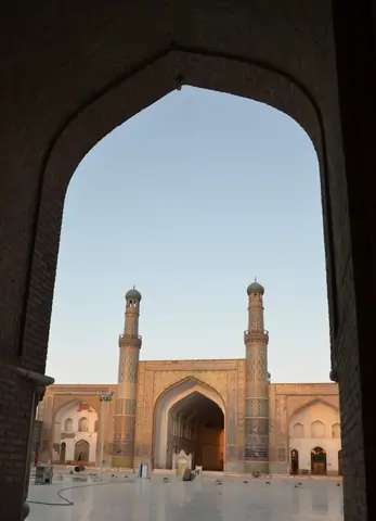
Herat
City · Herat
Herat is a city located in western Afghanistan, near the border with Iran. It is the third-largest city in Afghanistan and the capital of Herat province. It is known for its rich history and cultural heritage, and is…
Jowzjan
State · Jowzjan
Jowzjan is a northern plains province with an industrial and market rhythm. Sheberghan, gas-field roads, agricultural settlements and routes toward Balkh and Faryab make the province a working junction of fields, fuel,…
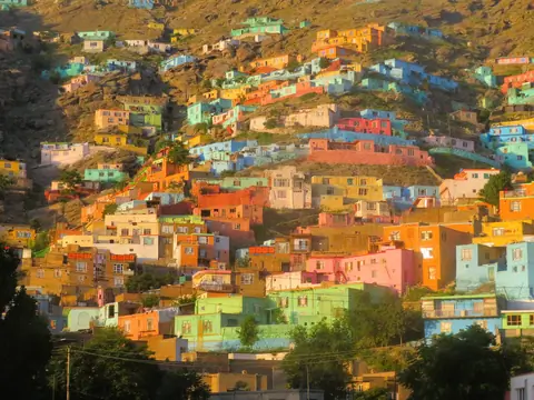
Kabul
City · Kabul
Kabul is the capital and largest city of Afghanistan. It has a population of around 4.5 million people and is located in the eastern part of the country, at the foot of the Hindu Kush mountain range.Kabul may have…
Kandahar
State · Kandahar
Kandahar is southern Afghanistan with urban gravity: Kandahar city, Arghandab orchards, market streets, Durrani memory and roads toward Helmand, Ghazni and Pakistan. It needs serious context: shrines, fields, courtyards…
Kandahar city
City · Kandahar city
Kandahar City is the second-largest city in Afghanistan and is located in the southern part of the country. The city count around 500'000 inhabitants. While the city has a rich history and culture, it has been affected…
Kapisa
State · Kapisa
Kapisa is a small province with a precise geography north of Kabul. Mahmud-e Raqi, orchard valleys, Kohistan and Kohband roads, Panjshir adjacency and Parwan links make it a compact capital-edge landscape of fields,…
Khost
State · Khost
Khost is a southeastern province centered on Khost city, with mountain edges, markets and Pakistan-facing road movement. Border proximity belongs to practical geography: local advice, permission, road timing, services,…
Kunar
State · Kunar
Kunar is an eastern river-valley province centered on Asadabad, where the Kunar River, forested slopes, bridges and Nuristan-facing mountains organize road movement. Water, slope, border proximity and valley advice…
Kunduz
State · Kunduz
Kunduz is one of northern Afghanistan’s field-and-road provinces. Kunduz city, the Kunduz River plain, irrigated agriculture, markets and Sher Khan Bandar route context make it a dense place of crops, traffic, services,…
Laghman
State · Laghman
Laghman is an eastern province of orchards, river valleys and road movement. Mehtar Lam, Alingar and Alishing valleys, Kabul River system context and routes toward Nangarhar and Kunar make it a compact but active…
Logar
State · Logar
Logar is Kabul’s southeastern valley threshold, centered on Pul-e Alam, Logar River fields and roads toward Gardez and Ghazni. Mes Aynak adds copper and Buddhist archaeological memory, while markets, farms and current…
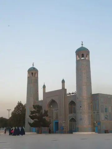
Mazar-i-Sharif
City · Mazar-i-Sharif
The 4th city of the country is the economic center of northern Afghanistan, some 60 km south of the Uzbek city Termez. It is known for its magnificent blue mosque and the tomb of Mohammed's cousin, and it is in his…
Nangarhar
State · Nangarhar
Nangarhar is eastern Afghanistan’s warm lowland province: Jalalabad, the Kabul River, citrus and field work, bazaars, university-town traffic and Torkham-Khyber route pressure all sit inside one active system of heat,…
Nimruz
State · Nimruz
Nimruz is Afghanistan’s southwestern desert-border province. Zaranj, Sistan basin memory, Helmand-delta water, Iran-facing roads, trucks, heat and dry crossings make it a place where borders, water scarcity, distance…
Nuristan
State · Nuristan
Nuristan is a forested eastern mountain province centered on Paroon, distinct valley communities and difficult roads. Nuristani identity, river valleys, tree cover, weather, community permission and verified guidance…
Paktia
State · Paktia
Paktia is a southeastern mountain province centered on Gardez, where passes, markets and roads toward Kabul and Khost shape movement. Its travel logic sits in weather, slope, local advice, service towns and the…
Paktika
State · Paktika
Paktika is a southeastern border province of dry highlands, Sharan, dispersed settlements and Pakistan-facing roads. It is best read through distance, markets, community expectations, current guidance, water points, dry…
Panjshir
State · Panjshir
Panjshir is a narrow mountain province north of Kabul, organized by the Panjshir River, Bazarak, valley villages and high slopes. Its resistance memory needs careful handling, without heroization, slogans or spectacle,…
Parwan
State · Parwan
Parwan is a Kabul-north corridor province where Charikar, Bagram, Salang approaches, Ghorband-side roads, fields and market traffic gather before the Hindu Kush tightens movement. Road condition, weather and local…
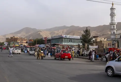
Pul-i-Khumri
City · Pul-i-Khumri
At the crossroads of Afghanistan’s major northern routes—linking Kabul, Kunduz, and Mazar-i-Sharif—lies Puli Khumri, a vibrant provincial capital rarely explored by travelers but rich in local life and character. With…
Samangan
State · Samangan
Samangan is a northern province centered on Aibak, with Takht-e Rostam, cave heritage, highland-steppe transitions and roads between Balkh and Baghlan. Heritage sits beside working traffic, fields, market timing, local…
Sar-e Pol
State · Sar-e Pol
Sar-e Pol is a northern interior province of fields, dry hills and linking roads. Sar-e Pol city, agricultural valleys and routes toward Jowzjan, Balkh and central highland approaches make movement feel local, slow and…
Takhar
State · Takhar
Takhar is a northeastern agricultural province where Taloqan, fields, Kokcha-side routes and roads toward Kunduz, Badakhshan and Tajik borderlands create a working landscape of markets, valleys, bridge points and…
Tashkurgan (Khulm)
City · Tashkurgan (Khulm)
Tashkurgan is a city in northern Afghanistan in Balkh Province, which is the administrative centre of Khulm District. Its name translates from Uzbek as "stone fortress". The city is also known as Khulm in Dari, which…
Uruzgan
State · Uruzgan
Uruzgan is a central-southern highland province built around Tarinkot, valleys, dry mountains, fields and difficult roads. Agriculture, local movement, water points and access reality matter more than single-frame…
Wardak
State · Wardak
Wardak is Kabul’s western highland threshold, centered on Maidan Shahr and shaped by fields, passes and roads toward Bamiyan and Ghazni. Its geography is close to the capital yet ruled by weather, surfaces, villages,…
Zabul
State · Zabul
Zabul is a southern highland corridor centered on Qalat, dry hills, valley settlements and the Kabul-Kandahar road. Its value is in route memory, road discipline, water decisions, local confirmation and the geography…
No places to visit found
Try clearing filters or choosing a broader area.