Issyk Kul region

Orto-Tokoy water reservoir

The Orto-Tokoy reservoir is the first reservoir built in Kyrgyzstan. Construction began in 1941 and ended in 1960. It is located on the Chu River, behind the village of Kochkor. Its length is about 18 km, its volume is over 470 million cubic meters, and its maximum depth is 47 meters.

The main purpose of the reservoir is to regulate the water level of the Chuy River in order to irrigate for agricultural land in Chui Oblast and southern Kazakhstan.

Balykchy
Kyrgyzstan

Small seaside village on the north shore of Lake Issyk Kul. The beach is less than 2km from the mountains, making it a good starting point for exploring the Grigorivka valley.

Geo
Image
Ornok
Height
1205
Width
2686

Ornok (Ornek) is a small village on the northern shore of Lake Issyk Kul 18 km from Tamchi and Cholpon Ata. The place has been known for several millennia, the many petroglyphs on the heights of the village are proof of this. You can see the petroglyphs from the side of the road that leads to Chong Kemin Valley.

Geo
Contains

Merzbacher lake

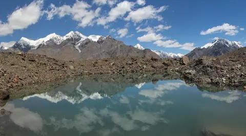
Lake Merzbacher is a high mountain lake dammed by the Inelchek Glacier, in the eastern part of the central Tien Shan, between the Tengri-Tag and Sary Jaz ridges. It is located at the confluence of the northern and southern branches of the Inylchek Glacier and feeds on meltwater. Water volume - 0.12-0.25 km³. Area - 4.5 km². Altitude above sea level - 3304 m.

Karakol
Kyrgyzstan

Manjyly-Ata valley

On the southern shore of Issyk-Kul, one kilometer east of Ton Bay, is the holy place "Manzhaly-Ata". Manzhyly-Ata became famous at the end of the 17th century, in the epic "Manas" he is mentioned as sacred to the Kyrgyz people. Although Manzhaly was the patron saint of nomadic pastors, he was a famous professor of Sufism, who during his lifetime spread Islam among the Kyrgyz nomadic pagans.

Tosor
Kyrgyzstan

Khan Tengri peak

Khan-Tengri is a mountain peak, the highest point of the Republic of Kazakhstan on the border with Kyrgyzstan and China, its height is 7010 m above sea level. “Lord of the sky” as the ancient Turks called one of the highest peaks of the Tien Shan - Khan-Tengri peak. The central Tien Shan, located at the junction of the borders of Kazakhstan, Kyrgyzstan and China, is one of the most popular centers of world mountaineering. Khan-Tengri Peak is without a doubt a treasure of the Tien Shan. This is the second highest mountain in this northernmost of the Asian mountain ranges.

Engilchek
Kyrgyzstan

Kichi-Kyzyl-Suu

Discover the captivating Kichi-Kyzyl-Suu valley in Kyrgyzstan, named after the little red river that meanders through this 35-kilometre route. The valley is home to the Kichi-Kyzyl-Suu glacier and boasts peaks as high as 4,200 metres. Numerous small rivers, such as Kalya-Bulak and Chong Djaidektor, join the main river, adding to the valley's charm. While the highest peak bears the same name as the river, there are still 15 peaks over 4,000 metres awaiting their official names, the highest of which stands at 4,365 metres.

Kichi-Kyzyl-Suu
Kyrgyzstan

Kunguey Alatoo

The Kunguey Alatoo (Kungeï) is the range on the North of the Issyk Kul lake marking the border between Kyrgyzstan and Kazakhstan. The range is 280 km long for about 35 km width. The highest peak is the Choktal peak and culmines at 4771 meter altitude.

Cholpon-Ata
Kyrgyzstan

Oguz Bashi peak

Oguz Bashi is a mountain peak located in the Terskey Ala Too range of Kyrgyzstan, at the top of the Jeti Oguz valley. The peak has an elevation of 5,168 meters and is located in the Ak-Suu district of the Issyk-Kul region.

The climb to the summit of Oguz Bashi is considered to be a challenging but rewarding experience. The ascent typically takes several days and involves a combination of hiking, scrambling, and mountaineering. Along the way, climbers can enjoy stunning views of the surrounding mountains and valleys.

Jeti-Ögüz
Kyrgyzstan