Tajikistan

Code value
TJ
Nationality
Tajik
Path Element
tajikistan
Adjective
Tajik

Bulunkul lake

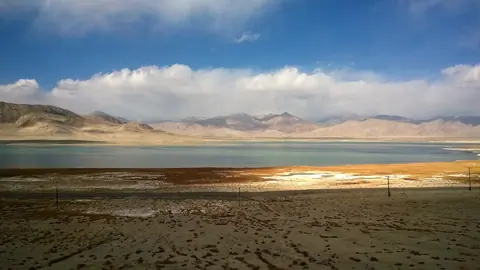
Of tectonic origin, the 3.4 km2 lake is located in the Murgab district of the Gorno-Badakhshan Autonomous Region in Tajikistan at an altitude of 3741 meters above sea level. The Issykbulak River empties into the lake, forming a swampy delta essential for herding. The region is one of the coldest and the lake is frozen until the end of May.

Bulunkul
Tajikistan

Ismoil Somoni Peak

Located in Tajikistan, in the Pamir Range, at an altitude of 7,495 meters, Somoni Peak is the highest peak in the country and Central Asia and the highest mountain in the former Soviet Union. It is a mountain of gigantic dimensions that appears surrounded by numerous glaciers. It is located at the confluence of the "Academy of Sciences" and "Pierre le Grand" chains.
Until 1933 it was known as Mount Garmo, then Stalin Peak until 1966, before it was renamed Communism Peak until 1998.

Vanj
Tajikistan

Shorkul lake

To the west of Karatorpok-Keskesdala high plateau and Rangkul village, the lake is endehoric, and flows into the neighboring lake, Rangkul lake, which is about the same size, about 5km long. It fills up with snowmelt and is completely frozen over in winter. Depending on the year or the season, these two lakes can double in size.
13 km from the main M41 road, you can visit these lakes when traveling between Lake Karakul and the capital of the eastern Pamirs, Murgab.

Alichur
Tajikistan

Rangkul lake

To the west of the high plateau of Karatorpok-Keskesdala and the village of Rangkul, the lake is endehoric, and receives its waters from its neighboring lake, Lake Shorkul, which is about the same size, about 4km long. It fills up with snowmelt and is completely frozen over in winter.

Rangkul
Tajikistan

Dzharty-Gumbez (Jarty Gumbez)

On the edge of the world, among the vast expanses of the Alichur-Yug Range, there is a small farm, modestly and mysteriously called Jarti-Gumbez. This is a place where time stands still and history whispers its secrets through the centuries.

Archaeologists have come to the conclusion that Jarti-Gumbez was home to generations of people long before our era, back in the Bronze Age. They have unearthed evidence of the Scythian era that has left its mark on the land. We can only imagine what stories and destinies each stone, each object discovered under the layer of time hides.

Murgab
Tajikistan

Karajylga peak

Karajylga Peak (Karajilga ; Qara Jelga) is a peak in the Vakhan mountain range, marking the border between the Tajik Pamirs and the Afghan Vakhan Corridor. It is the top of three glaciers on the northwest, north, and northeast flanks. The northeast glacier is on Afghan territory while the other 2 are on Tajik territory.

Murgab
Tajikistan

Khargush is a small hamlet in the Tajik Pamirs located 3900 meters south of the Khargush pass (4344 meters above sea level). Nothing really interesting, it's mostly a border guard post. It is also the intersection between the road that leads to the Khargush pass to the north, Lake Zorkul and its nature reserve to the east and the village of Langar to the west. There are a few guesthouses on the farms in the village. The panorama on the Vakhan range is impressive. Kohe Belandtarin peak is over 6200 meters, and its altitude is disputed, but it is one of the highest peaks in Afghanistan.

Geo

Zorkul lake

Zorkul Lake stretches from east to west for about 20 km and is located 4120 meters above sea level on the Afghan-Tajik border. Part of the waters have their source in the Vakhan chain located to the south and its Concordia peak (5,470 m), about 11 km (as the crow flies) south of the lake. The northern half of the lake is in Tajikistan, at the foot of the Alichur-South Range. where it is protected as part of the Zorkul Nature Reserve. From the lake, to the west, flows the Pamir River, tracing the Afghan-Tajik border. It is therefore a source of the Amu Darya or the Oxus river.

Zorkul
Tajikistan