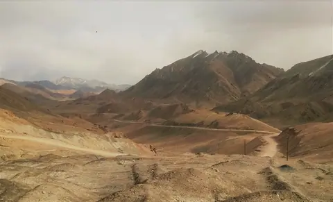
Gorno-Badakhshan

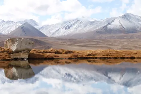
Rangkul lake

To the west of the high plateau of Karatorpok-Keskesdala and the village of Rangkul, the lake is endehoric, and receives its waters from its neighboring lake, Lake Shorkul, which is about the same size, about 4km long. It fills up with snowmelt and is completely frozen over in winter.

Rangkul
Tajikistan
Dzharty-Gumbez (Jarty Gumbez)

On the edge of the world, among the vast expanses of the Alichur-Yug Range, there is a small farm, modestly and mysteriously called Jarti-Gumbez. This is a place where time stands still and history whispers its secrets through the centuries.

Archaeologists have come to the conclusion that Jarti-Gumbez was home to generations of people long before our era, back in the Bronze Age. They have unearthed evidence of the Scythian era that has left its mark on the land. We can only imagine what stories and destinies each stone, each object discovered under the layer of time hides.

Murgab
Tajikistan

Karajylga peak

Karajylga Peak (Karajilga ; Qara Jelga) is a peak in the Vakhan mountain range, marking the border between the Tajik Pamirs and the Afghan Vakhan Corridor. It is the top of three glaciers on the northwest, north, and northeast flanks. The northeast glacier is on Afghan territory while the other 2 are on Tajik territory.

Murgab
Tajikistan

Khargush is a small hamlet in the Tajik Pamirs located 3900 meters south of the Khargush pass (4344 meters above sea level). Nothing really interesting, it's mostly a border guard post. It is also the intersection between the road that leads to the Khargush pass to the north, Lake Zorkul and its nature reserve to the east and the village of Langar to the west. There are a few guesthouses on the farms in the village. The panorama on the Vakhan range is impressive. Kohe Belandtarin peak is over 6200 meters, and its altitude is disputed, but it is one of the highest peaks in Afghanistan.

Geo

Zorkul lake

Zorkul Lake stretches from east to west for about 20 km and is located 4120 meters above sea level on the Afghan-Tajik border. Part of the waters have their source in the Vakhan chain located to the south and its Concordia peak (5,470 m), about 11 km (as the crow flies) south of the lake. The northern half of the lake is in Tajikistan, at the foot of the Alichur-South Range. where it is protected as part of the Zorkul Nature Reserve. From the lake, to the west, flows the Pamir River, tracing the Afghan-Tajik border. It is therefore a source of the Amu Darya or the Oxus river.

Zorkul
Tajikistan

Akbaital pass (Ak-Baital)

Akbaital, Kyrgyz word meaning "white mare" is a pass of the Eastern Pamirs, located on the M41 motorway between Osh and Murghab. The height of the pass is 4655 meters. The highest point of the Pamir Highway. The pass is open all year round and it connects the Sarykolsky and Muzkol ridges and separates the Karakul Lake Basin from the upper reaches of the South Akbaital River (Murghab Basin). The climb from the Muzkol valley is relatively gentle, but on the south side it is steeper with several hairpin bends.

Murgab
Tajikistan

Bibi Fatima Zahro hot springs

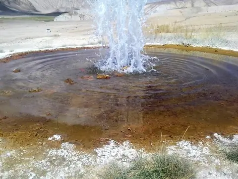
The hot spring of Bibi Fatima-Zahro (name of the daughter of the Prophet Muhammad) is located at 3200 meters alt. on the heights of the village of Yamchun, near the river. According to beliefs, it is also a place of worship.

The thermal spring would have healing properties against urological and gynecological diseases, digestive problems, etc. The locals also believe that being exposed to water improves female fertility. Although located in the high mountains, it has a temperature above 40 degrees Celsius all year round.

Yamchun
Tajikistan

Yamchun is a tajik village 90 km upper than Ishkashim village and 2 km lower than Vrang village. It stand on the shore of the Panj river and at the border of the Wakhan corridor, just in front of the Afghan Yamit village. The village was built at the foot of the fortress with the same name and the hot springs of Bibi Fatima Zahro. The fortress was built from the 3rd century BC, but human sign in this region are older. 

Geo
Contains