Issyk Kul region

Petroglyphs of Ornok

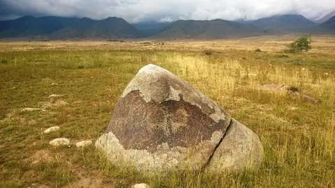
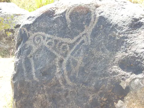
Maybe less know, petroglyphs of Ornok are of the same period than petroglyphs of Cholpon Ata. A wild open air museum, where you have to find by yourself stones drawn during bronze, iron ages, and during the early Middle Ages. There are more than 2000 stone boulders, with images of ancient hunters and animals such as the mountain goat (Ibex), deers: totemic animals of the Bugu's tribe, dogs, leopards, horses, camels.

Ornok
Kyrgyzstan
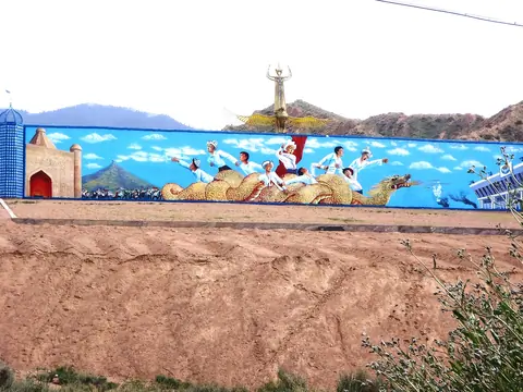
The village of Barskoon, with a population of over 9,000, lies on the southern shore of Lake Issyk Kul. Remains have been found proving the existence of man as far back as the 4th century BC.

Geo
Contains
Image
Ottuk
Height
631
Width
1140

The first village on the beach, when you're arriving by the West of the South shore of the Issyk Kul's lake.

Geo

Pobeda peak

Le pic Pobeda est le point culminant du massif du Tian Shan et du Kirghizistan, à l'est du pays à la frontière avec la Chine. Il constitue un symbole historique pour différents pays. Il est gravi pour la première fois en 1956 par Vitaly Abalakov. Sommet particulièrement dangereux, son ascension est principalement tentée par des alpinistes russes.

Engilchek
Kyrgyzstan

Petroglyphs of Cholpon-Ata

Near the former airport of Cholpon Ata, you may find a large site of petroglyphs from Bronze Age and some sacred places. There are thousand of drawings. First were painted by the Andronov tribes (Andronic), the former Sintashta tribe who colonized Central Asia around 3800 year BC. They were agro-pastoral. Then, we can see paintings from Scythian's tribes (VIII-III centuries B.C.). Most of drawings show animals like ibex or deer for example. 

Cholpon-Ata
Kyrgyzstan

Teshik-Kul lake

There are two lakes, 1,2 km long and a lower lake 340 meters long. They are part of the Terskey Alatoo and the Issyk Kul oblast, even if the river flow into the Naryn bassin. It's situated near a popular local place names Jilu Suu (Jeli Suu) and its hot sources. From hot spring, you may count one day to hike there and back. It's also part of a trek between the valley of Karagoman till Jilu Suu through these lakes. Long time ago, these lakes were created after the retreat of the glacier Kelter (Köl Toer) which culminates at 4478 meters altitude.

Jeti-Ögüz
Kyrgyzstan

South Engilchek

The Southern Engilchek Glacier is the largest and most spectacular of the two branches of the Engilchek Glacier system, stretching over 60 kilometers across the central Tien Shan massif. Recognized as the sixth longest non-polar glacier in the world and the largest in Kyrgyzstan, its ice thickness reaches up to 200 meters in some places. Unlike its northern counterpart, known for hosting Lake Merzbacher and its spectacular drainage phenomenon, the southern glacier is distinguished by serving as a unique access route to the highest peaks in the region.

Engilchek
Kyrgyzstan