Rural Development in the Arun Valley, Nepal
A long-term rural development project in eastern Nepal
A long-term rural development project in eastern Nepal

Nestled in Kyrgyzstan's Ak-Talaa District, the Terek Canyon (or gorge) along the Terek River is a stunning highlight on the scenic route from Baetov to Tash Rabat. Set against the dramatic backdrop of the Baybiche Too mountain range, this area showcases striking contrasts: lush green river oases near Baetov transition into rugged, arid badlands where the Terek carves through steep rocky cliffs in earthy reds, oranges, and browns under vast skies.
Naryn
Kyrgyzstan
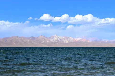
Ak-Tash, peaking at 3,853 m, is the only isolated mountainous formation at the heart of the Song Kul Lake basin. Located northeast of the lake, the range extends about 10 km long and 6 km wide. At its northeastern end, the Djaman Echki and Ak-Tash valleys converge to form the Djaman Echki Pass (3,341 m), which separates this massif from the Song Kul Too range.
Song Kul lake
Kyrgyzstan
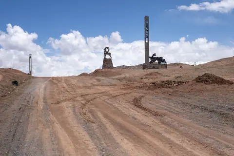
The Tajik border post of Kyzyl Art, between Kyrgyzstan and Tajikistan, is located at an altitude of 4,206 meters, less than 2 km south of the Kyzyl Art Pass, which sits at 4,288 meters and marks the geographical border. The border post is open year-round but may close for a few days in winter to clear newly fallen snow. It is situated in the Zaalaisky Range, dominated by Lenin Peak, and on the M41 highway, a legendary route known to motorcyclists.
Kyzyl-Art
Tajikistan
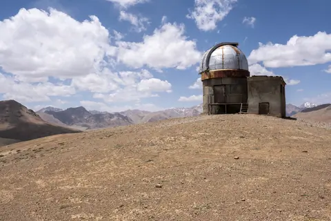
Shorbulak Observatory is one of the world’s highest astronomical sites, perched at over 4,300 m in the remote mountains near Murghab, in the Tajik Pamirs. Built during the Soviet era for space and infrared research, its dry, cloudless skies made it an ideal place for observing stars and cosmic rays. Though now abandoned, the observatory remains accessible and fascinating to visit: rusted domes, old telescopes, and crumbling Soviet-era buildings stand silent against a dramatic mountain backdrop.
Murgab
Tajikistan
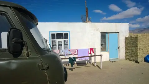
Karakul is a remote village located on the eastern shore of Lake Karakul in the Gorno-Badakhshan Autonomous Region of Tajikistan. Situated at an elevation of approximately 3,960 meters (12,992 feet), it is one of the highest settlements in the Pamir Mountains.
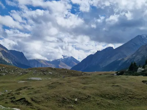
Nestled among the jagged peaks of the Tian Shan, the Turgen Ak-Suu valley stretches like a forgotten path of the gods, a secret passage where time seems to stand still. Here, nature reigns supreme, sculpting landscapes with the seasons and the eternal winds blowing from the high snows of the Turgen Ak-Suu glacier.
Turgen-Ak-Suu
Kyrgyzstan
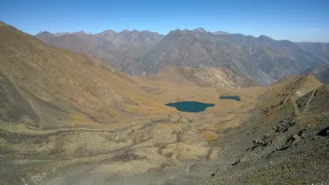
The Suluu Toer Lakes are nestled on the northern slopes of the Kyrgyz Alatoo mountain range. They can be easily reached on foot from the northern entrance of the Too-Ashuu tunnel, following the old road leading to the Too-Ashuu (or Ashuusu) Pass. The lower lake, a square-shaped basin, spans 160 meters in width and sits at an altitude of 3,191 meters. The upper lake, nearly 200 meters wide, lies 300 meters higher at an elevation of 3,245 meters. This area is perfect for a scenic 5-kilometer hike, taking approximately two hours each way.
Too-Ashuu
Kyrgyzstan
Enigmatic and graceful, the snow leopard (or irbis) is a symbol of survival and beauty in the harsh conditions of the mountain peaks.
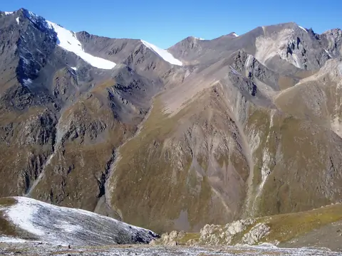
Situated at an altitude of 3929 meters, this high mountain pass stands as a silent sentinel between the Gorge of Kichi Kyzyl Suu and the Jukutchak Gorge. This natural spectacle offers a panoramic canvas of the surrounding peaks and valleys.
To the north, the pass opens up to a breathtaking view of the 5000 towering peaks of Karakol and Oguz Bashi, their snow-capped majesty dominating the horizon. The air is crisp, and the panorama stretches to capture the rugged grandeur of It-Tish Peak (4808 m) on the western front, overseeing the vast expanse of the Juku Valley below.
Karakol
Kyrgyzstan