Peaks

Chapdara lakes

Lake Chapdara, also known locally as Kuli Chapdara, is the largest of the Alaudin Lakes, with a diameter ranging from 300 to 400 meters. It is part of a system of three main lakes and several smaller ones, all connected by underground streams and mountain runoff.

The lake is situated in the upper part of the Pasrud Valley, in a section known as the Chapdara Valley, located in the Ayni district of northwestern Tajikistan, within the Gissar range of the Fann Mountains. It lies at the foot of Chapdara Peak, which rises to 5,049 meters.

Artuch
Tajikistan

Alauddin lakes

Lake Alaudin, also known in Russian as "Mutnye ozera" (the murky lakes), is a high-altitude lake located at 3,519 meters in the upper part of the Pasrud Valley in Tajikistan’s Fann Mountains. It lies directly at the foot of the Kaznok Pass, which rises to 4,088 meters, surrounded by 5000 m. alt. peaks such as Chimtarga, Mirali, Energia, Zamok and Chapdara.

Artuch
Tajikistan

Zarafshan Range

The Zarafshan Range is a mountain range in Tajikistan and Uzbekistan, part of the Pamir-Alay mountains. Almost all of the range belongs to the drainage basins of the Zarafshan River.

The Persian name is believed to possibly be a reference to gold found in bed of the Zarafshan River and its tributaries, which has ushered prosperity to the region from ancient times.

The highest point of 5,489 metres is the peak Chimtarga.

Panjakent
Tajikistan

Damdjailoo

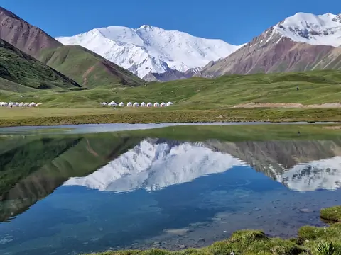
The Lost Lakes in front of Lenin Peak on the Alai Range are a unique corner of nature that mesmerizes with its beauty and mystery. Located in the heart of the mountains, these lakes have a unique charm and attraction for travelers and mountaineers.

Surrounded by majestic peaks, these lakes are a true paradise for adventurers and outdoor enthusiasts. Here, every guest can find plenty of opportunities to climb the pristine peaks while enjoying the grandeur of the mountain scenery and the purity of the mountain air.

Sary-Mogol
Kyrgyzstan

Muztagh Ata BC

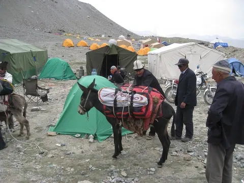
Base camp of the Muztagh Ata peak.

Dates 2018 for Muztagh Ata ascent (date of arriving at Kashgar) :

12.June 2018

14.June 2018   

17.July 2018     

24.July 2018   

03.August 2018

For more information, please contact us by email  

Tashkurgan
Xinjiang Weiwuerzizhiqu
China

Song Kul Too

The Son Kul Range is a mountain range located north of Lake Son Kul in central Kyrgyzstan. This mountain range is part of the inner Tien Shan and forms the natural border of the northern side of the Son Kul high-altitude plateau.

The range rises above the lake and creates a picturesque mountain landscape with alpine meadows, wide pastures, and steep slopes. The Son Kul Range covers the northern part of the lake and reaches its highest point at an altitude of 3,650 meters above sea level.

Song Kul lake
Kyrgyzstan

Teleti gorge West

The Teleti Gorge, in the upper part of the Jeti Oguz valley, is a quiet and scenic valley of the Teskey Ala-Too range. It begins in dense fir-tree forests, where tall spruces shade the slopes and the air carries the fresh scent of resin and damp earth. The Teleti River flows along the valley floor, and its constant murmur accompanies hikers along the trail. In several places, small waterfalls descend from the rocky slopes, especially during the snowmelt season.

Karakol
Kyrgyzstan

Tulpar-Kol lake

In the heart of the Achyk Tash valley, the Toulpar Kel lakes form an array of shimmering small lakes situated on the ancient moraine of the Lenin Glacier. Located just opposite the base camps of Lenin Peak (7,134 m), they offer a haven of tranquility in a magnificent setting, between high-altitude steppes and snowy peaks. A pedestrian bridge allows easy access to the base camps and the trail leading to Lenin Peak.

Sary-Mogol
Kyrgyzstan

At-Bashi range

The At-Bashi Range is 135km long and culminates at 4,801 meters. It stretches from the southwest, from the Muz-Tor valley and the Tuz-Bel Ashuu pass, to the northeast to Bosogo and the Kayindi pass. North of the chain is the At-Bashi Valley at an average altitude of 2,500 meters. North side, the slopes are steep and covered with rich vegetation. On the south side, the plain of Ak-Say is at an average altitude of 3200 meters. The highest peak is the Rhianydd at 4,801 meters. The At-Basi peak rises to 4788 meters and is the second highest in the chain.

At-Bashi
Kyrgyzstan