Peaks

Tulpar-Kol lake

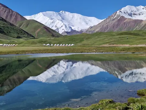
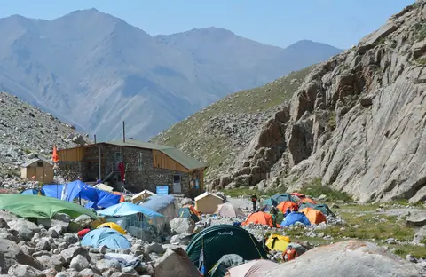
In the heart of the Achyk Tash valley, the Toulpar Kel lakes form an array of shimmering small lakes situated on the ancient moraine of the Lenin Glacier. Located just opposite the base camps of Lenin Peak (7,134 m), they offer a haven of tranquility in a magnificent setting, between high-altitude steppes and snowy peaks. A pedestrian bridge allows easy access to the base camps and the trail leading to Lenin Peak.

Sary-Mogol
Kyrgyzstan
Pyramidal peak

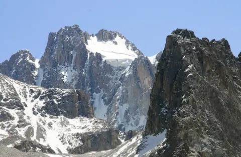
The Pyramidal peak is located on the crest of the Turkestan chain belonging to the Pamir-Alai massif. It is a monolithic granite mountain that attracts experienced climbers on mixed routes. It lies between the border of Tajikistan and Kyrgyzstan and 9 lanes have already been opened on the Kyrgyz side. The approach is made by going up the valley of Kara-Suu and by the glacier of Asan-Usin. The area is known as Karavshin, the valley that brings together the rivers surrounding the peak. It is the second highest peak in Turkestan after Skalisty peak, which is 5,612 meters high.

Karavshin
Kyrgyzstan

Teshik-Kul lake

There are two lakes, 1,2 km long and a lower lake 340 meters long. They are part of the Terskey Alatoo and the Issyk Kul oblast, even if the river flow into the Naryn bassin. It's situated near a popular local place names Jilu Suu (Jeli Suu) and its hot sources. From hot spring, you may count one day to hike there and back. It's also part of a trek between the valley of Karagoman till Jilu Suu through these lakes. Long time ago, these lakes were created after the retreat of the glacier Kelter (Köl Toer) which culminates at 4478 meters altitude.

Jeti-Ögüz
Kyrgyzstan

Pobeda peak

Le pic Pobeda est le point culminant du massif du Tian Shan et du Kirghizistan, à l'est du pays à la frontière avec la Chine. Il constitue un symbole historique pour différents pays. Il est gravi pour la première fois en 1956 par Vitaly Abalakov. Sommet particulièrement dangereux, son ascension est principalement tentée par des alpinistes russes.

Engilchek
Kyrgyzstan

Korona The Crown peak

Pic Corona is located in the Ala Archa Valley and its National Park. It is located at an altitude of 4860 m and thus one of the highest peaks in the Kyrgyz Alatoo range. The peak at the top of Ak-Say glacier, its northern part, 1.68 km from Semenov Tianchansky peak. It consists of six rock towers forming a crown.
It takes 4 days for its ascent. The first base camp is at the foot of the Ak-Say glacier, and there is a small refuge at the foot of the summit at an altitude of 3800 meters.
In winter the ascent can be done by ski touring.

Ala-Archa
Kyrgyzstan

Oguz Bashi peak

Oguz Bashi is a mountain peak located in the Terskey Ala Too range of Kyrgyzstan, at the top of the Jeti Oguz valley. The peak has an elevation of 5,168 meters and is located in the Ak-Suu district of the Issyk-Kul region.

The climb to the summit of Oguz Bashi is considered to be a challenging but rewarding experience. The ascent typically takes several days and involves a combination of hiking, scrambling, and mountaineering. Along the way, climbers can enjoy stunning views of the surrounding mountains and valleys.

Jeti-Ögüz
Kyrgyzstan

Manas peak

Manas Peak is the highest point of the Talas Ala-Too ridge and is located to the west of the chain, 3km north of the border with Uzbekistan. Its height is 4484 m above sea level. It is the highest point of the Archaluu massif. It lies between the Ak-Tashluu Valley in the east and the Kiuriush-Kel Valley in the west. To the east, it is bordered by a glacier 3 km long.

The summit received its name in honor of the great hero told in the epic tale of the same name.

Talas
Kyrgyzstan

Lenin peak

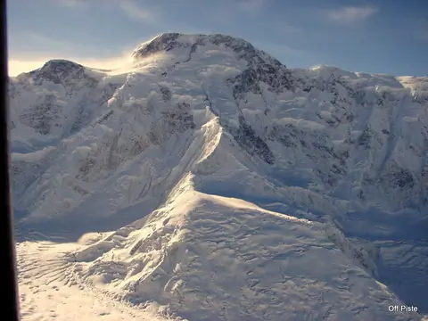
The second highest peak of Kyrgyzstan, situated in the Pamir at the border with Tajikistan. It rises at the altitude of 7134m. Best period for the ascent is from July to August, some years till early September.

Sary-Mogol
Kyrgyzstan

Kunguey Alatoo

The Kunguey Alatoo (Kungeï) is the range on the North of the Issyk Kul lake marking the border between Kyrgyzstan and Kazakhstan. The range is 280 km long for about 35 km width. The highest peak is the Choktal peak and culmines at 4771 meter altitude.

Cholpon-Ata
Kyrgyzstan