- Contains
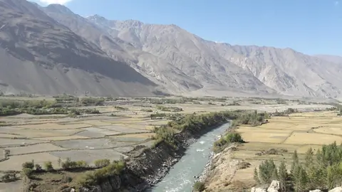
Nestled in the remote and breathtaking Wakhan Valley of Tajikistan's Gorno-Badakhshan region, the ancient Khakhka Fortress (also known as Qah Qaha, Kaahka, or Kah-Kakha) stands as a dramatic sentinel above the village of Namadgut. Perched on a massive natural cliff overlooking the swirling Panj River—which forms the international border with Afghanistan—this crumbling citadel dates back to around the 3rd–2nd century BCE, during the height of the Kushan Empire and the flourishing of the Silk Road.
Ishkashim
Tajikistan
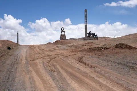
The Tajik border post of Kyzyl Art, between Kyrgyzstan and Tajikistan, is located at an altitude of 4,206 meters, less than 2 km south of the Kyzyl Art Pass, which sits at 4,288 meters and marks the geographical border. The border post is open year-round but may close for a few days in winter to clear newly fallen snow. It is situated in the Zaalaisky Range, dominated by Lenin Peak, and on the M41 highway, a legendary route known to motorcyclists.
Kyzyl-Art
Tajikistan
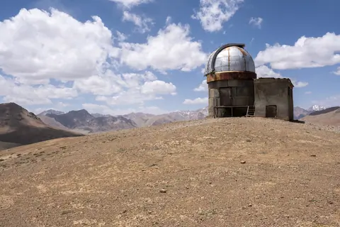
Shorbulak Observatory is one of the world’s highest astronomical sites, perched at over 4,300 m in the remote mountains near Murghab, in the Tajik Pamirs. Built during the Soviet era for space and infrared research, its dry, cloudless skies made it an ideal place for observing stars and cosmic rays. Though now abandoned, the observatory remains accessible and fascinating to visit: rusted domes, old telescopes, and crumbling Soviet-era buildings stand silent against a dramatic mountain backdrop.
Murgab
Tajikistan
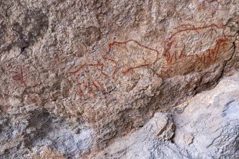
The Shakhty cave paintings, located at over 4,200 meters altitude in the Eastern Pamirs, near Murghab, are among the oldest examples of rock art in Central Asia. Discovered in 1958 by Soviet archaeologist Vladimir Ranov, they depict a striking hunting scene painted in red pigment derived from local iron oxide. The artwork shows a central figure—possibly a hunter or a shaman—wearing a bird-shaped mask and aiming at a wild boar, accompanied by yaks and a bear, some of which are pierced with arrows.
Murgab
Tajikistan
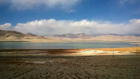
Karakul is a remote village located on the eastern shore of Lake Karakul in the Gorno-Badakhshan Autonomous Region of Tajikistan. Situated at an elevation of approximately 3,960 meters (12,992 feet), it is one of the highest settlements in the Pamir Mountains.
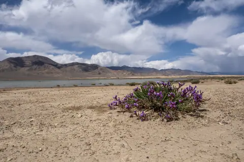
Located on the plateau of Alichur, this lake is salty. It is 4 km long and 2 km wide. It is fed by the Tamdy River, but the lake is endorheic. It is located 6km southwest of the village of Alichur.
Alichur
Tajikistan
Of tectonic origin, the 3.4 km2 lake is located in the Murgab district of the Gorno-Badakhshan Autonomous Region in Tajikistan at an altitude of 3741 meters above sea level. The Issykbulak River empties into the lake, forming a swampy delta essential for herding. The region is one of the coldest and the lake is frozen until the end of May.
Bulunkul
Tajikistan
Located in Tajikistan, in the Pamir Range, at an altitude of 7,495 meters, Somoni Peak is the highest peak in the country and Central Asia and the highest mountain in the former Soviet Union. It is a mountain of gigantic dimensions that appears surrounded by numerous glaciers. It is located at the confluence of the "Academy of Sciences" and "Pierre le Grand" chains.
Until 1933 it was known as Mount Garmo, then Stalin Peak until 1966, before it was renamed Communism Peak until 1998.
Vanj
Tajikistan
To the west of Karatorpok-Keskesdala high plateau and Rangkul village, the lake is endehoric, and flows into the neighboring lake, Rangkul lake, which is about the same size, about 5km long. It fills up with snowmelt and is completely frozen over in winter. Depending on the year or the season, these two lakes can double in size.
13 km from the main M41 road, you can visit these lakes when traveling between Lake Karakul and the capital of the eastern Pamirs, Murgab.
Alichur
Tajikistan